


The Sidney R. Knafel Map Collection
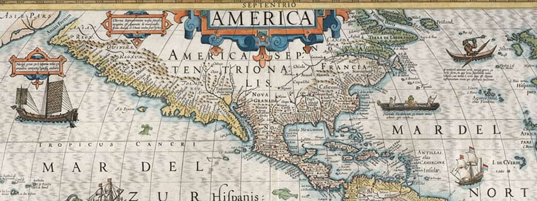
The Sidney R. Knafel Map Collection is history itself in the form of a unique collection of atlases, maps, and globes dating from 1434 well into the 19th century. Many of these rare objects and documents are the subject of a 1992 book, Shedding the Veil: Mapping the European Discovery of America and the World by Thomas Suárez, and comprised in that year an exhibit at the Addison Gallery on the campus of Phillips Academy to mark the 500th anniversary of Columbus’ landing in the New World.
The collection was given to Phillips Academy in December 2011 by Sidney Knafel, class of 1948, in honor of the 18-year tenure leadership of Barbara Chase as she stepped away from the Headship and he from his role as Charter member of the Board of Trustees. Mr. Knafel collected the items as a personal passion inspired by looking out over the Atlantic from Martha’s Vineyard and imagining how this land must have struck those Europeans who arrived half a millennium ago.
At Mr. Knafel’s request, the collection will be on continual display within the teaching spaces of the Academy to be used as classroom tools for students. Digitization affords opportunities for teachers and students to work freely with the collection at the highest resolution so that images of globes, atlases, and renderings of coastal New England and New France at various stages of exploration and incorporation by Europeans can be examined closely.

Partnership with the Boston Public Library
Phillips Academy accepted a generous offer from the Boston Public Library to digitize the collection. To date, the maps in good physical condition have been digitized and supported by the Boston Public Library's Leventhal Collection which provides the opportunity to search the collection by location or subject and to zoom in to observe the intricate details of the maps. Collaboration with the Leventhal collection supports Mr. Knafel's extraordinary vision of making the maps readily available to engage young peoples' curiosity about the world.
The atlases and globes in the collection represent a more difficult challenge, and we need to understand more about their condition before we determine how best to handle them.
For now, the digital collection lives on the Norman B. Leventhal Map Center site within on the BPL.
This project is federally funded with LSTA funds through the Massachusetts Board of Library Commissioners.